LABORATORY: CNR-ISPC
NAME OF THE INSTRUMENT
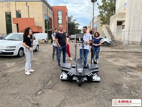
Georadar Stream C, IDS System
GENERAL DESCRIPTION
The georadar available in MOLAB is used in several fields of investigations due to its extremely handy, fast, and completely non-invasive. The georadar method (also known as Ground Penetrating Radar - GPR) is a high-resolution technique that allows to acquire a large amount of information on large areas in the first meters of the subsoil, referable to the presence of buried bodies, cavities, structures of archaeological interest, subsoil stratifications, etc.
Stream C is the compact GPR array solution for real-time 3D mapping of underground utilities and features. Thanks to the increased level of accuracy, provided by a massive antenna array.
Benefits of the Stream C include High Productivity: Surveys only need to be performed in one direction to ensure optimal detection of both longitudinal and transversal structures; Reduced user fatigue: Thanks to electronic ride height adjustment and a motor-assisted drive wheel; Facilitates large surveys.
The system can be towed manually or with a small vehicle, increasing the acquisition speed (up to 6 km/h).
TECHNICAL DESCRIPTION
The portable georadar instrument is equipped with a control system, a series of 34 antennas in two polarisations with frequency of 600MHz.
Referent:
Giovanni Leucci giovanni.leucci@cnr.it
