LABORATORY: CNR ISPC – AIRLAB
NAME OF THE INSTRUMENT
VNIR + IRT multisensor platform on drone
GENERAL DESCRIPTION
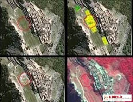
It is a multisensor platform conveyed by a quadcopter drone and consists of a multispectral camera that acquires 4 bands of the visible spectrum up to the near infrared (VNIR), a thermal camera (IRT) and an RGB camera. remotely managed with a single remote control, it is designed for applications in the field of archaeological prospecting. Through the integration and fusion of data acquired with the VNIR and IRT cameras, it is possible to identify, georeference and insert proxy indicator, into the map, such as changes in humidity (damp-marks), variations in vegetation growth (crop-marks) and presence of organic materials on the surface, referable to the presence of underground structures and transformations at the scale of the site and landscape of cultural interest. The digital models that can be obtained by processing the images acquired with the RGB camera with structure from motion algorithms will allow the creation of detailed maps and orthophotos and, through post processing based on visualization techniques, identify microtopographic variations of archaeological interest.
The system is suitable for documenting and detecting archaeological contexts, excavation phases and architectural surfaces. Regarding the latter, the possibility of acquiring thermographic images at close range with the drone can be exploited, in addition to thermographic images acquired from the ground, for the detection of degradation pathologies and forms of alteration such as plaster detachment, patinas, deposits, and the presence of constructive modifications of the wall structures behind it.
An optimal use of the system is to integrate it with other remote sensing data on an aerial and satellite platform for multi-scale and multi-sensor applications.
TECHNICAL DESCRIPTION
The multisensor system consists of a quadcopter drone equipped with a removable radiometric 30Hz thermal imaging camera with quick coupling and release with integrated optical camera that can be installed on the drone, a VIS-NIR multispectral camera, an RGB digital camera. The acquisition can take place with a flexible configuration, one or two chambers together or, only RGB chamber, RGB chamber with multispectral, RGB chamber with thermal chamber. Below are the technical specifications of the drone and the cameras.
Referent:
Nicola Masini nicola.masini@cnr.it
NAME OF THE INSTRUMENT
Thermal imaging camera FLIR VUE PRO R, 640
GENERAL DESCRIPTION
Drone thermal imaging camera for thermographic analysis of historical buildings for the purpose of their energy and environmental improvement.
The analysis with these tools allows, in integration with other analyses to identify geometric and material thermal bridges, investigate the emissivity of the materials, support the classification wall typologies and the use of other analyses for the thermophysical characterisation of the materials such as heat flow measurement, identify problems in the laying of materials and discontinuities, investigate the performance of glass and frames (emissivity, differences in thermal resistance, installation errors, air and water infiltrations), study air cracks and water leaks on the envelope and the presence of condensation.
TECHNICAL DESCRIPTION
FLIR VUE PRO R Drone thermal imaging Camera, 640x512 pixels, 19mm, 9Hz FLIR VUE PRO R, 640, 19mm, 9Hz, FOV 32x26
Referent:
Elena Gigliarelli elena.gigliarelli@cnr.it
