LABORATORIO CNR ISPC
NAME OF THE INSTRUMENT
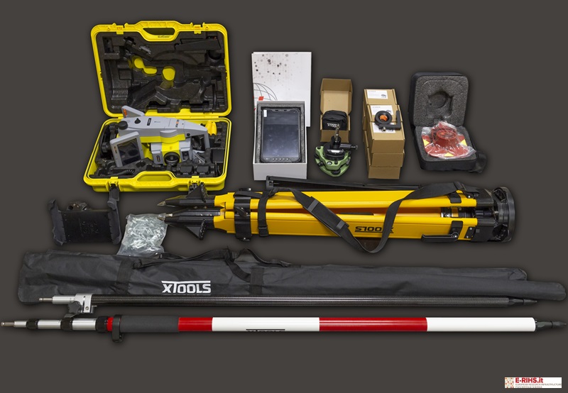
Total Station
- Leica TS16 P 3″ R1000
- GeoMax Zoom 95
GENERAL DESCRIPTION
The Total Station is a measuring instruments ordinarily used in the topographic surveys to position points on the Earth’s surface, determining its coordinates.
The Total Station is equipped with a sensor that measures angles and distances of a series of points and determines their exact spatial location relative to a predefined coordinate system. In particular, the total station supplied in the MOLAB, the Leica TS16 P 3" R1000, is able to automatically and continuously adapt to site conditions, such as rain, fog, dust, sun, glare. It also has software through which complex data is processed in practical and realistic 3D models. The robotic total station GeoMax Zoom 95, on the other hand, enables single-operator use and is particularly suitable for the periodic, high-precision monitoring of architectural structures.
TECHNICAL DESCRIPTION
Model name: Leica TS16 P 3″ R1000
- Angular measurement: Accuracy Hz and V - Absolute, continuous, diametrical – 1” (0.3 mgon), 2” (0.6 mgon), 3” (1 mgon), 5” (1.5 mgon)
- Distance measurement:
- prism (GPR1, GPH1P) = 1.5 m to 3500 m; non-prism/ any surface = R500: 1.5 m to > 500 m, R1000: 1.5 m to > 1000 m
- accuracy/ measurement time: single (prism) = 1 mm + 1.5 ppm / typically 2.4 s; single (any surface) = 2 mm + 2 ppm / typically 3 s
- Field software: Leica Captivate with apps
- Processor: TI OMAP4430 Dual-core ARM® Cortex™ 1 GHz A9MPCore™; operating system Windows EC7
- Power management: exchangeable Lithium-Ion battery; operating time 5-8 h
- Data storage: internal memory = 2 GB; memory card = SD card 1 GB or 8 GB
- Interfaces: RS232, USB, Bluetooth®, Wi-Fi
- Environmental specifications: working temperature range = – 20°C to + 50°C; dust/water (IEC 60529)/humidity = IP55 / 95%, non-condensing
Referent:
Giuseppe Scardozzi: giuseppe.scardozzi@cnr.it
Model name: GeoMax Zoom 95
- Angular measurement: Angular Accuracy 1” (0.3 mgon)
- Distance measurement:
- Prism: 1mm + 1.5 ppm to 3.500m in “Standard” mode and to10.000m in “Long” mode.
- EDM: 2mm + 2ppm to1000 m
- Measurement time: 2-6 seconds
- Field software: X-PAD Ultimate survey TPS
- Operating system: Microsoft® Windows® EC 7.0
- Power management: exchangeable Lithium-Ion battery 4.4 Ah/7.4 Volt; operating time 8 h
- Data storage: internal memory = 2 GB; memory card = SD card 1 GB
- Interfaces: USB, Bluetooth®, Wi-Fi, WLAN
- Display and keyboard: 5” (inch), WVGA 800x480, colour, touch
- Environmental specifications: working temperature range = – 20°C to + 50°C; IP55 non-condensing
Referents:
Daniele Ferdani daniele.ferdani@cnr.it
Andrea Angelini andrea.angelini@cnr.it
